

Severe Threat For Today? | Josh O
After things warm up past freezing point, this advisory that is up till 9 will go off and everything that falls will be rain, SPC doesn't even have parts of Maryland in the risk of thunderstorm activity, and I agree. With that said, we may hear a rumble of thunder in the air across the state...even if your not in the risk of storms.
Maps and Advisories | Josh O
 |
| Regional Radar Still from Intellicast |
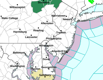 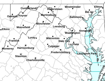 |
LEFT: NWS Sterling Map | RIGHT: NWS Mt Holly Map
TAN: Special Weather Statement
|
 |
| SPC Severe Weather Outlook for Maryland. |
Sneak peek of today's weather discussion from the National Weather Service in Sterling
AREA FORECAST DISCUSSION
NATIONAL WEATHER SERVICE BALTIMORE MD/WASHINGTON DC
812 AM EST MON JAN 23 2012

.SYNOPSIS...
HIGH PRESSURE WILL MOVE AWAY FROM THE REGION TODAY AS LOW PRESSURE
APPROACHES FROM THE WEST. A COLD FRONT WILL CROSS THE REGION LATE
TODAY...AND HIGH PRESSURE WILL BUILD BEHIND THIS SYSTEM THROUGH
MID-WEEK. A STORM SYSTEM WILL IMPACT THE REGION LATE IN THE WEEK.