Moving time.


This site has been the home of Maryland's Quick and Easy weather for over a year now, and its time we move on. So, with that, pending how the weather behaves among other things, our new website will become the new mymdweather.org by mid April. We will put a new post out MWC Facebook, Twitter, and here as a warning that we are about to do it.

This message is to give you preparation as to when it will happen. If you prefer this site over the new one, its totally understandable and for that reason, this site will remain active at the URL: mdwxctr.blogspot.com. We hope you understand and thanks for holding tight with us as this process has gone on.

-Josh Owens
MWC Director and Forecaster

2.0

We announced it on Facebook and Twitter, now to bring it here! We have activated our new site as a DEMO for you to view and "mess with" for a bit at mdwxctr.wordpress.com!
This site is still and always will be available for you at www.mymdweather.org (or mdwxctr.blogspot.com).

Some new features:
  • "Newspaper" style home page. 
  • All the original pages that we have now along with some older favorites. 
  • New amazing Mobile layout. 
  • And lots of new upgrades for you to explore! 

We want to know what you think about it!

Feel free to:
E-Mail us at info@mymdweather.org
Comment on the MWC 2.0 Facebook Page
Tweet or DM us on Twitter

Rest of the week...

You enjoying these temps outside? I know I am! This will continue into the weekend but we must loose the sunny skies at some point that point may be Friday when storms will most likely roll in from the west. As to if them are Severe? Different story, as of now its not likely but details will be on Facebook as it develops.


Radar from Intellicast


Weather never stops, neither do we. Follow us on Twitter and Facebook for the latest forecasts.


Radar from Intellicast


Weather never stops, neither do we. Follow us on Twitter and Facebook for the latest forecasts and updates while the active weather takes a break after the "snowfall" in southern Maryalnd...


Feb 29. You only get it every Four years...

Tomorrow will be interesting as:
A: Its the Leap Day (Which has pretty much as nothing to do with the weather BUT it was worth noting)
and...
B: That the SPC has placed us in a risk of some boomers tomorrow. Models have rain and storms over us by 1:00pmish or later, maybe 3:00. Looks like primarily a rain event with some thunder mixed in. One of those things to watch for sure.


Day 1 Outlook from SPC
Day 2 Outlook from SPC

Few other side notes for you...

We have added a few new feature's on MWC Facebook including looping Radar, RSS Feed from NWS on Advisories in Maryland, and direct access to MWC: Twitter both Tweets and Re-Tweets (which you can follow to! ). Hope you enjoy!

Quiet For Now!


Weather never stops, neither do we. Follow us on Twitter and Facebook for the latest forecasts and updates while the active weather takes a break...


Wind Advisory

Map of Forecast Area
Dark Tan Represents Wind Advisory


544 PM EST FRI FEB 24 2012

...WIND ADVISORY IN EFFECT UNTIL MIDNIGHT EST TONIGHT...
...HIGH WIND WARNING IS CANCELLED...

THE NATIONAL WEATHER SERVICE IN BALTIMORE MD/WASHINGTON HAS
ISSUED A WIND ADVISORY...WHICH IS IN EFFECT UNTIL MIDNIGHT EST
TONIGHT. THE HIGH WIND WARNING HAS BEEN CANCELLED.

* TIMING...THE STRONGEST WINDS WILL BE THIS EVENING.

* WINDS...WEST 25 TO 30 MPH WITH GUSTS UP TO 50 MPH.

PRECAUTIONARY/PREPAREDNESS ACTIONS...

A WIND ADVISORY MEANS THAT WIND GUSTS OVER 45 MPH ARE EXPECTED.
WINDS THIS STRONG CAN MAKE DRIVING DIFFICULT...ESPECIALLY FOR
HIGH PROFILE VEHICLES. USE EXTRA CAUTION.

TORNADO WATCH #38

WW0038 Radar


HazardTornadoesEF2+ Tornadoes
LikelihoodModerateLow
Severe Wind65 kt+ Wind
HighModerate
Severe Hail2"+ Hail
ModerateLow

BULLETIN - IMMEDIATE BROADCAST REQUESTED
   TORNADO WATCH OUTLINE UPDATE FOR WT 38
   NWS STORM PREDICTION CENTER NORMAN OK
   120 PM EST FRI FEB 24 2012
   
   TORNADO WATCH 38 IS IN EFFECT UNTIL 800 PM EST FOR THE
    FOLLOWING LOCATIONS
   
   MD 
   .    MARYLAND COUNTIES INCLUDED ARE
   
   CALVERT              CHARLES             DORCHESTER          
   SOMERSET             ST. MARYS           WICOMICO            
   WORCESTER           

EFFECTIVE THIS FRIDAY AFTERNOON AND EVENING FROM 120 PM UNTIL 800
   PM EST.
   
   TORNADOES...HAIL TO 1 INCH IN DIAMETER...THUNDERSTORM WIND GUSTS
   TO 75 MPH...AND DANGEROUS LIGHTNING ARE POSSIBLE IN THESE AREAS.
   
   THE TORNADO WATCH AREA IS APPROXIMATELY ALONG AND 95 STATUTE
   MILES EAST AND WEST OF A LINE FROM 5 MILES NORTH NORTHWEST OF
   PATUXENT RIVER MARYLAND TO 25 MILES SOUTHWEST OF MYRTLE BEACH
   SOUTH CAROLINA.  FOR A COMPLETE DEPICTION OF THE WATCH SEE THE
   ASSOCIATED WATCH OUTLINE UPDATE (WOUS64 KWNS WOU8).
   
   REMEMBER...A TORNADO WATCH MEANS CONDITIONS ARE FAVORABLE FOR
   TORNADOES AND SEVERE THUNDERSTORMS IN AND CLOSE TO THE WATCH
   AREA. PERSONS IN THESE AREAS SHOULD BE ON THE LOOKOUT FOR
   THREATENING WEATHER CONDITIONS AND LISTEN FOR LATER STATEMENTS
   AND POSSIBLE WARNINGS.
   

Severe Weather Risk

Late Winter Boomer Risk. | Feb 23 | Josh O

Well as noted a few days ago we were monitoring a severe weather risk for Feb 24, well it has shown to be true as the Storm Prediction Center has parts of Southern Maryland and the Southern Delmarva under slight risk of Severe weather. The risk factors will be up on MWC: Facebook once they come out from SPC and are reviewed. Preliminary idea for a storm cenario like this is that wind is the biggest risk. General risk of thunderstorm's for the rest of the state based on the midday outlook from SPC. Updates to come...

"The Rain Drops Keep Falling On My Head"

*Lyric's from BJ Thomas Iconic Song "The Raindrops Keep Falling on My Head"

Rain will be moving through the area overnight, lighter showers for the most part but a good moderate or heavy rain shower is certainly possible.

Intellicast


Map of Forecast AreaMap of Forecast Area
LEFTNWS Sterling Map | RIGHTNWS Mt Holly Map


Weather never stops, neither do we. Follow us on Twitter and Facebook for the latest forecasts and updates...

Like a dish of Rocky Road Ice Cream.

Severe Weather after the "Snow"? | Josh O, Severe Weather Forecaster | Feb 21, 2012

I entitle the post "Like a dish of Rocky Road Ice Cream," because of the snow we ALMOST had coming to us this past weekend, and now we look to possible rocky weather ahead as spring thinks about showing up on winters territory.

The SPC has placed areas to our south under a slight risk for severe weather to the south on Friday and based in how this pattern goes, I would put it past this system to maybe push north and possibly cause some rumbles on our front door. Will it be severe? To soon to tell, but we are watching it for sure! Something to think about for sure as we enter into one of the warmer weeks we will see this winter possibly.

The next day...

Post Storm Review | Josh O | Feb 20, 2012

Big bummer to friends in the north...no snow even in Annapolis, Maryland sadly, we were hoping it would reach you guys even in Baltimore for a good dusting! This was a system that was more unpredictable then a spinning top on a table!

Then one group that made out well is friends in Southern Maryland, where close to 2" was reported! You guys have finally gotten a quasi "legit" snow covering this winter! Sadly it wont last long with highs foretasted to get near the 50's today. Take pictures and get some play time in before it all vanishes! The southern Delmarva made out well to! Thanks to Justin Berk, Meteorologist, and Foot's Forecast for help on some of these forecasts and reports! I hope MAYBE make a video with a summary later and post it on YouTube...

I'm still adding to the reports map I have been working on updating and want to make it a bit more populated so please send in your reports! Do you have snow? How much? If I get totals, I'll add that to the map to.

FINAL OUTLOOK | NOWCASTING FROM HERE


#mdwx | Snow Totals Final Call | Feb 19-20, 2012 | Josh (Short Range Forecaster) | THIS IS NOT AT ALL SET IN STONE


All totals have taken a considerable hit due to direction and conditions the system is in. Long range models have a role in this forecast but they are still in a flip-flop pattern and that they may not know what may happen.
From here we look to the shorter range models and use them a reference. As of now this becomes more of a “Nowcasting” then a “Forecasting” situation

FINAL CALL ON SNOW TOTALS


• Western MD: Dusting or Less
• North Baltimore Suburbs: Dusting or Less
• Southern Baltimore/Northern DC Suburbs: 1”-2”
• Southern DC Suburbs: 2”-3”
• Southern Maryland: 3”-5”
• Northern Delmarva: Dusting or Less
• Southern Delmarva: 2”-5”

A North shift of 50 miles could bump up the totals and a South shift of 50 miles could rob us of anything. This will be down to the last minute and ANYTHING CAN STILL HAPPEN. Its just the way winter is at this point. We are still watching it!

SECOND CALL ON TOTALS

10:17p Update:


 Egads! Models are trending further south again with this storm which could mean a major decrease in our accumulation potential-but before we commit to anything, we'll sleep on this overnight and see tomorrow morning how the storm has developed on the radar and what else is happening in the atmosphere and then give a final call on the storm by noon tomorrow-sleep well and good night. (Mark)


ORIGINAL POST:


NAM 66hr
WOW-what a morning! We have been through a whirlwind of trying to forecast this storm as yesterday it looked like some parts of Maryland could get a 12+, then the late evening and overnight model runs suggested that there would be no snow north of DC and Annapolis or no snow at all in Maryland. Now at 10am this morning we are almost back to where we started about 24 hours ago-w/ the GFS model still saying this is staying to the south say south of Fredricksburg, VA and the Canadian and NAM models (see the attached NAM model) giving most of MD significant snow, again maybe a foot in some spots and moving the snow line up north past the PA/MD border. I would like see when the 11:30 am GFS run comes out that if it verifies w/ the NAM-but remember the GFS has not always been perfect. So whatever you do, don’t drop your guard on the potential of this storm yet based on what local TV weather reports say-there are many reputable meteorologists on the web who strongly disagree w/ the local weather reports and are still very concerned about this storm moving north. 

Foots Forecast, whom We along with meteorologist Justin Berk collaborate with often, are suggesting that this storm could be stronger than everyone thinks since there is a decent train of moisture feeding into this system from the Pacific. I know this sounds crazy to some, but based on what we have analyzed, we will not at this point significantly decrease our forecasted snow totals-just a slight decrease, but some we have unchanged. Again this is our second call on the storm, we’ll do a final call tomorrow before the storm arrives-remember this storm is forming as we speak-nothing set in stone yet. 

SECOND CALL ON SNOWFALL


1-2 Inches: Western Maryland but closer to the Potomac (all snow)
inches North of Baltimore and Frederick, Upper Eastern Shore-should be all snow is this zone
2-4 Inches: Baltimore City on south to Bowie and Annapolis (all snow),
3-4 Inches: Mid and Lower Eastern Shore (except parts of Dorchester)-starts as rain (espec. south) but here we could see 4+ if changeover to snow is sooner (rain to snow)
3-6 Inches: DC and immediate suburbs-more south, less north (all snow)
6-8 Inches: Southern Maryland (lower PG, Charles, St Marys, Calvert) over across the bay to Dorchester County, could see +10 if changeover to snow is sooner. (rain to snow)

"Nothing Set in Stone..."

We are watching the model's and looking over the data and will have a new map out by around 10:00a. Sadly things have taken the southward dive and totals will follow. We are watching it, but being cautious on it for sure! (Josh & Mark)

FIRST OUTLOOK


Map of Forecast Area
Light Blue Represents Winter Storm Watch
FIRST OUTLOOK ON POSSIBLE TOTALS FOR WEEKEND STORM | Mark G & Josh O

Winter Storm watches have already been posted in the zones just to our west, I feel confident those watches and then warnings should extend into Maryland by tomorrow morning.The storm should begin moving in by late Sunday morning/early Sunday afternoon. Earlier model runs had the storm starting overnight Saturday into Sunday, but this system looks to be moving a little slower and now lasting into the early hours of Monday morning especially along the Eastern Shore. Snow may begin as rain in Southern Maryland and the lower Eastern Shore, but as the cold front drops down into those areas Sunday afternoon, any rain will quickly change over to all snow. 


OFFICIAL FIRST SNOW FORECAST MAP FOR FEB 19-20 STORM
There is still some uncertainty on amounts due to a possible change in track-so we have to allow for some adjustments possibly to our forecast. 
So here is our 1st call-(not final call) much of this is based on the NAM model, but I've backed off somewhat lower due the NAM's tendency to overdue amounts:
2-4 inches Western Maryland but closer to the Potomac (all snow)
1-3 inches North of Baltimore and Frederick, Upper Eastern Shore-should be all snow is this zone
3-6 inches Baltimore City on south to Bowie and Annapolis (all snow),
3-6 inches Mid and Lower Eastern Shore (except parts of Dorchester)-starts as rain (espec. south) but here we could see 6+ if changeover to snow is sooner (rain to snow)
5-7 inches DC and immediate suburbs (all snow)
6-10 inches Southern Maryland (lower PG, Charles, St Marys, Calvert) over across the bay to Dorchester County, could see +10 if changeover to snow is sooner. (rain to snow)

What to expect during and after the storm:
1. Road conditions will deteriorate by late Sunday afternoon into Sunday evening
2. Heavier bursts of snow will reduce visibility on Sunday
3. Expect possible flight and mass transit delays on Sunday afternoon/evening
4. Icy and snow covered roads overnight Sunday and Monday morning.
5. Untreated roads will remain treacherous Monday night/Tuesday morning
6. Mild trend as next week progresses through the rest of February-in essence, this could quite possibly be our last shot at getting a decent winter storm, but then again anything can happen through early April.

It's coming, but how much?

Winter Analysis | Mark G | 6:45a Feb 17, 2012

We know its snow that's coming, but the totals are uncertain

This has been one of those storms where all the ingredients needed for a classic east coast snow storm are not perfectly in place-if that would be the case, forecasting east coast snow storms would be easy, but maybe the man upstairs wants us to stay humbled abut what we know and dont know about weather. Anyhow, 2 models that have been pretty on par this winter w/ storms are calling for snow for Maryland, but while they may differ on snow amounts, they do both seem to indicate that we probably will be starting off this storm as snow especially from DC/BAlt on south and east. Do you remember one of the variables i mentioned about time of day the storm begins playing a factor? Well, looks like the storm may not really start to get going until late Sunday morning-which could mean warmer temps espec near the Chesapeake, Southern Maryland and eastern Shore where the water influence will play a part since water temps are warmer than normal. But the hope is (if you like snow) that as the storm passes to our south and east, the cold air will be able to get in and interact with the storm changing the rain south and east to all snow all the way to the coast. B/c of that , I want to wait until the afternoon to give specific accumulations for specific areas of Maryland. The NAM model from last night above indicates that a swath of 8-12 inches could fall south of DC in Charles and St Mary's County, but I'm little concerned about that being true since we could be rain before the changeover for a while in those areas lowering those accumulations.

The NAM Snow Depth Forecast Map


Here is the GFS model forecasting lower accumulations-maybe this is factoring in that we could start off as rain awhile before the changeover, for instance Southern maryland looks like in this forecast model to be getting 3-6 inches. As you can see, the models are forecasting much less snow for areas above DC and Annapolis-more to come this afternoon.

GFS Forecast

Maybe? Maybe Not? Nothing is official 4 days out...

Winter Analysis | Mark Gonzalez | Feb 15, 2012

Disclaimer: "This is just an early speculation of what could happen and by no means is that set in stone."

Well, I dont know yet about it being "the big one" but everybody now is starting to pay notice to a possible coastal snowstorm for Sunday into Monday this President's Day weekend. Again once we get to about Friday, I think we can feel like we get a better handle on what is going to happen, but in this early stage of the game, I would say there are 2 possible scenarios:

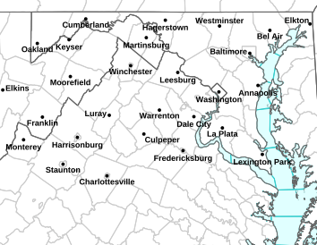
Scenario #1. The low pressure tracks up the east coast, but moves a bit inland and Maryland sees a rain/snow mix (rain changing to snow from Baltimore on east as the storm wraps up)-some areas from DC/Balt on west could see 6+ inches that get all snow.
Scenario #2. The low pressure tracks up the east coast, but takes a more coastal track just east off the Delmarva or right along the coast itself. Maryland sees an all snow or mostly snow event. Some areas from Balt/DC on south and east in Maryland see 12 Inches of Snow.

This is just an early speculation of what could happen and by no means is that set in stone. The variables always to consider with these type of coastal storms on how much snow we get or whether it will be rain or snow will be track, time of day of the arrival of storm, intensity of the precip, how much cold air can be supplied from the north. STAY TUNED.

Connections.

Weather never stops, neither do we. Follow us on Twitter and Facebook for the latest forecasts and updates...


Maryland Weather Center | Recent Posts

Current Watches, Warnings and Advisories for Maryland Issued by the National Weather Service

SPC Tornado/Severe Thunderstorm Watches

NWS headlines - Top News feature

Local HD Radar

Regional RADAR